Myanmar Map: Regions, States & Getting Around
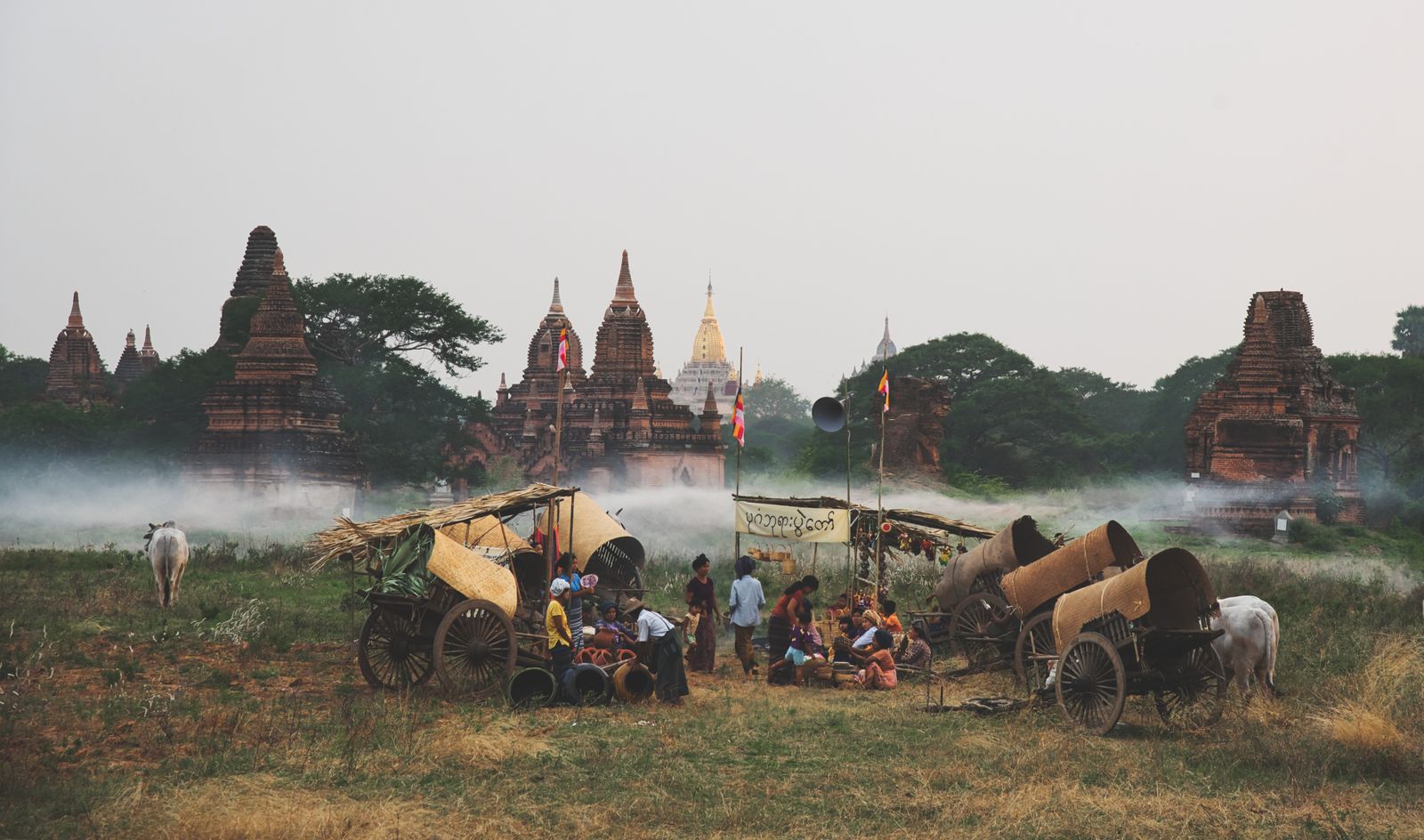
Photo: True Lay (Pexels)
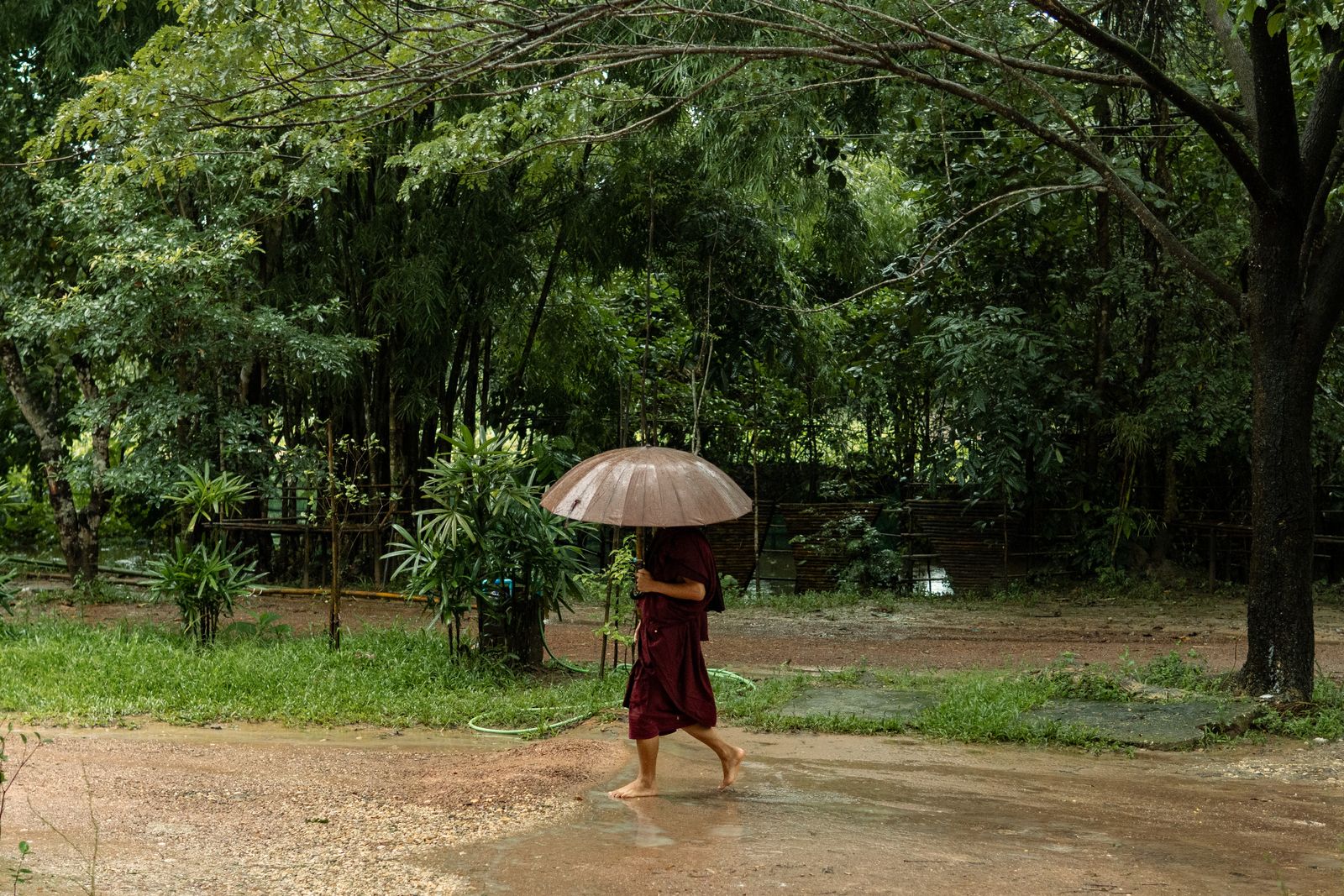
Myanmar sits at the heart of mainland Southeast Asia, sharing borders with five countries — India, Bangladesh, China, Laos, and Thailand — and stretching from the Himalayas in the north to the Andaman Sea in the south. Understanding how the country is organised on a myanmar map helps enormously when planning an itinerary: the distances are substantial, transport options vary by region, and the character of each area differs dramatically from the next.
Where Is Myanmar?
Myanmar (also known as Burma) occupies a large and geographically varied territory in mainland Southeast Asia. It lies roughly between latitudes 10°N and 28°N, making it one of the more elongated countries in the region — the straight-line distance from its northernmost tip to its southernmost point is over 2,000 kilometres.
To the northwest lies India (Mizoram, Manipur, Nagaland, and Arunachal Pradesh states) and Bangladesh. To the northeast, a long border follows China’s Yunnan Province. To the east are Laos and Thailand. To the west and southwest, Myanmar faces the Bay of Bengal and the Andaman Sea. This geography gives the country a strikingly diverse landscape: snow-capped peaks in the far north (Hkakabo Razi, the highest point in mainland Southeast Asia), tropical forests in the centre, fertile river deltas in the south, and long coastlines in the Rakhine and Tanintharyi regions.
The capital is Naypyidaw, a purpose-built city in the centre of the country, though Yangon (formerly Rangoon), in the south, remains the largest city and main international gateway.
The Administrative Divisions: States and Regions
Myanmar is divided into seven states (associated with ethnic minority populations) and seven regions (predominantly Bamar-majority areas), plus the Union Territory of Naypyidaw. The distinction matters for travel: states often represent highland or border areas with distinct cultures and sometimes separate travel logistics, while regions cover the central lowlands and major population centres.
Myanmar States and Regions at a Glance
| Division | Type | Main city / hub | Notes for travellers |
|---|---|---|---|
| Yangon Region | Region | Yangon | Main international gateway, colonial architecture, Shwedagon Pagoda |
| Mandalay Region | Region | Mandalay | Second city, Bagan nearby, cultural heartland |
| Naypyidaw Union Territory | Union Territory | Naypyidaw | Capital city; wide boulevards, political centre |
| Sagaing Region | Region | Sagaing | Thousands of pagodas, craft villages |
| Bago Region | Region | Bago (Pegu) | Day trip from Yangon, reclining Buddha |
| Magway Region | Region | Magway | Dry zone, oil fields, Mrauk-U access point |
| Ayeyarwady Region | Region | Pathein | Irrawaddy Delta, rice cultivation, umbrella-making |
| Shan State | State | Taunggyi / Nyaung Shwe | Inle Lake, balloon festival, Ruby mines, diverse ethnic groups |
| Kachin State | State | Myitkyina | Jade mines, confluence of the Ayeyarwady, mountainous north |
| Kayah (Karenni) State | State | Loikaw | Small state, Kayan “long neck” culture, scenic lakes |
| Karen (Kayin) State | State | Hpa-An | Limestone karst, caves, rivers; gateway towards Thailand |
| Chin State | State | Hakha | Remote highlands, traditional villages, trekking |
| Rakhine (Arakan) State | State | Sittwe | Bay of Bengal coast, ancient Mrauk-U ruins |
| Mon State | State | Mawlamyine | Coastal, colonial legacy, Golden Rock access |
| Tanintharyi Region | Region | Dawei | Mergui Archipelago, beaches, diving |
Major Cities and What They Offer Travellers
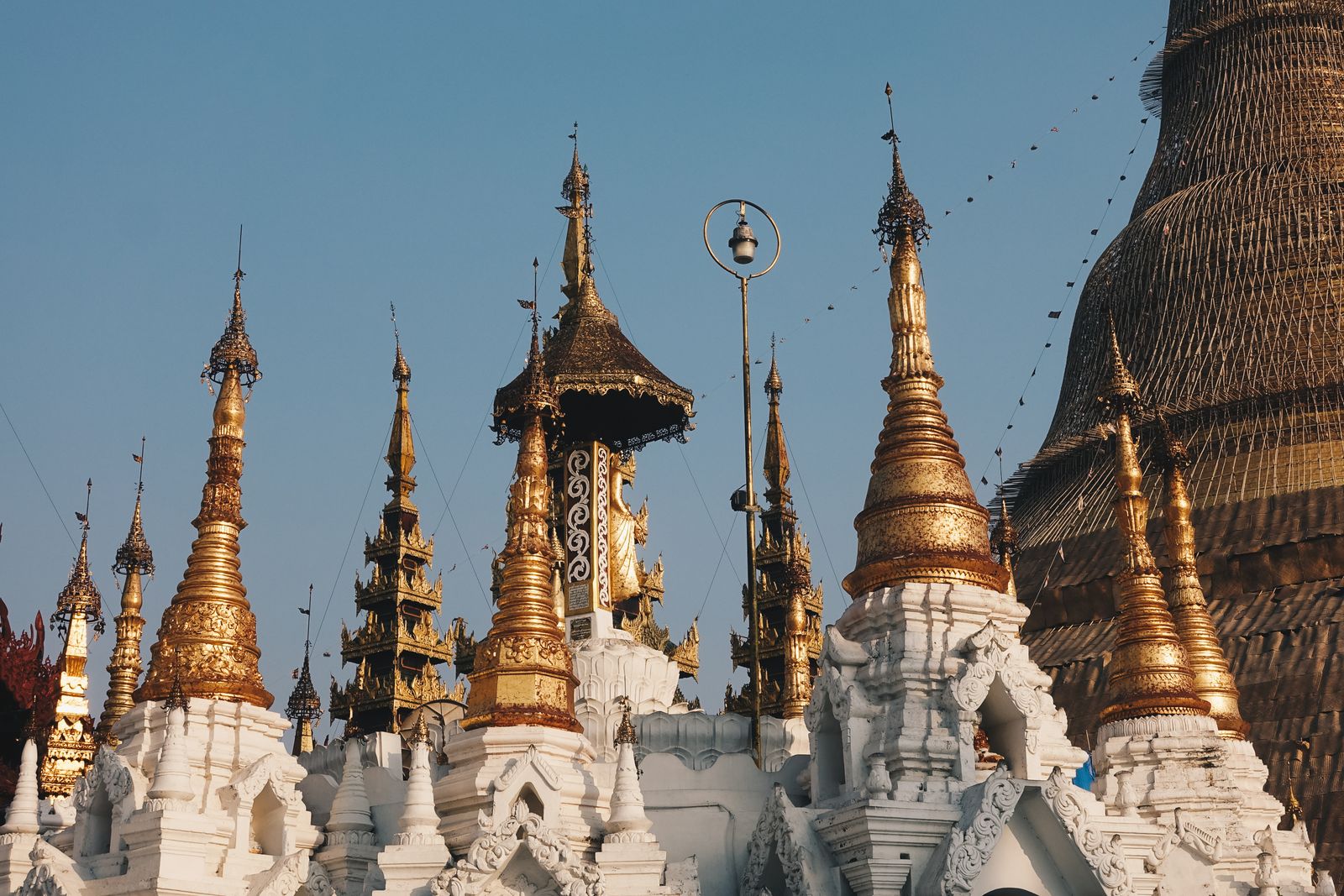
Yangon is the starting point for most international visitors. The city holds the densest concentration of colonial-era architecture in Southeast Asia, several of the country’s most important pagodas (including the gilded Shwedagon), and the widest range of restaurants, guesthouses, and transport connections. Most flights into Myanmar land at Yangon International Airport.
Mandalay, in the north of the central region, is the cultural heartland — home to royal palaces, the last seat of the Burmese monarchy before British annexation, and numerous artisan crafts including gold-leaf production, silk weaving, and traditional puppet making. It serves as the hub for reaching Bagan and the surrounding ancient capitals.
Bagan (in Mandalay Region) is arguably Myanmar’s most iconic destination: a plain studded with thousands of ancient Buddhist temples and pagodas built between the 9th and 13th centuries. Most visitors fly in from Yangon or Mandalay.
Inle Lake (in Shan State) draws visitors for its floating gardens, leg-rowing fishermen, stilted villages, and cooler highland climate. The nearest town is Nyaung Shwe; travellers typically fly into Heho Airport.
Hpa-An (Karen State) has grown in popularity among independent travellers for its dramatic limestone landscape, caves, and more accessible border crossing with Thailand.
Mawlamyine (Mon State) is a riverine city with a strong colonial legacy, a relaxed pace, and proximity to the Kyaiktiyo Pagoda (Golden Rock), one of Buddhism’s most important pilgrimage sites.
Getting Around Myanmar: Transport by Region
Myanmar’s size and terrain mean that choosing the right mode of transport between destinations is as important as choosing the destination itself.
By Air
Domestic flights are the fastest way to cover Myanmar’s distances and are commonly used on the major tourist circuit (Yangon – Bagan – Mandalay – Heho/Inle Lake). Several domestic carriers operate between these hubs. Booking in advance is advisable, particularly in peak season (November to February). Schedules and carriers change — verify current options close to your travel date.
By Bus
Long-distance express buses connect most major cities and towns and represent good value. Journey times are long — Yangon to Mandalay is roughly 8–9 hours, and journeys to Inle Lake or more remote destinations can be longer still. VIP and express buses with reclining seats and air conditioning are available on popular routes. For border crossings and routes into Shan or Karen State, check current road conditions and permit requirements.
By Train
Myanmar’s rail network is one of the oldest in Southeast Asia. Trains are slow by international standards, but the journeys themselves — particularly the Yangon to Mandalay overnight service, or the famous Gokteik Viaduct crossing in Shan State — are experiences in their own right. Reliability varies; trains are often late. Upper-class (first and sleeper) carriages are substantially more comfortable than ordinary class.
By Boat
River travel along the Ayeyarwady (Irrawaddy) River between Mandalay and Bagan is a classic Myanmar experience. Slow government ferries take two days; faster private express boats cover the same distance in well under a day. For short hops between towns, shared taxis and pickup trucks are affordable and widely available; in Bagan, bicycles and e-bikes are the preferred way to explore the temple plain.
Planning Your Route
Most itineraries for first-time visitors to Myanmar follow a classic loop: Yangon → Bagan → Mandalay → Inle Lake → Yangon. This circuit hits the country’s most celebrated sights and is well-served by domestic flights and express buses.
Travellers with more time can extend east into Karen State (Hpa-An), south to Mawlamyine and the Kyaiktiyo Pagoda, or north towards Hsipaw and Shan State for a different pace.
For a structured day-by-day breakdown of how to piece this together, see our full Myanmar itinerary guide. For the experiences worth prioritising at each stop, see our things to do in Myanmar overview.
Permit Requirements
Some areas of Myanmar historically required Foreign Travel Permits (FTPs) for foreign visitors — this applied to parts of Chin State, Kachin State, certain Shan State districts, and border regions. Requirements and access have shifted over the years and continue to change. Before travelling to any region outside the main tourist corridor, check current permit requirements through your embassy, a local travel agent, or your government’s travel advisory service.
Visa requirements and regulations for entering Myanmar also change — see our Myanmar visa guide for the latest information.
Moving between cities? Compare buses, trains & boats across Myanmar on 12Go Asia
FAQ
Where exactly is Myanmar located?
Myanmar is located in mainland Southeast Asia, bordered by India and Bangladesh to the northwest, China to the northeast, Laos and Thailand to the east, and the Bay of Bengal and Andaman Sea to the west and southwest. It sits between latitudes 10°N and 28°N, making it one of the more elongated countries in the region. The capital is Naypyidaw; the largest city and main international gateway is Yangon.
How many states and regions does Myanmar have?
Myanmar has seven states and seven regions, plus the Union Territory of Naypyidaw — fourteen administrative divisions in total. The seven states are historically associated with major ethnic minority populations: Chin, Kachin, Kayah, Karen (Kayin), Mon, Rakhine, and Shan. The seven regions — Ayeyarwady, Bago, Magway, Mandalay, Sagaing, Tanintharyi, and Yangon — are predominantly Bamar-majority areas.
What is the difference between Myanmar and Burma?
Myanmar and Burma refer to the same country. “Myanmar” is the name used by the current government (adopted in 1989) and is the official name recognised by the United Nations and most international bodies. “Burma” is the older English-language name, derived from the dominant Bamar ethnic group, and is still used by some governments, media organisations, and individuals — particularly those who associate the name change with the former military junta. Both names are widely understood within the country.
What is the best way to travel between major cities in Myanmar?
For long distances — particularly Yangon to Bagan or Mandalay — domestic flights are the fastest and most reliable option. Express buses are a good value alternative for those with more time; the Yangon–Mandalay route is well-served. Train travel is slow but scenic and culturally immersive. River ferries along the Ayeyarwady between Mandalay and Bagan are a classic choice for travellers who want to experience the country at a slower pace.
Is a permit required to visit all parts of Myanmar?
Not all parts of Myanmar require a permit, but some regions — particularly Chin State, parts of Kachin State, some Shan State areas, and border regions — have historically required Foreign Travel Permits for foreign visitors. Requirements change and should be verified with a local travel agent or your government’s travel advisory service before departing.